Fitting Space a Shuttle Photo to an Area on a Map
|
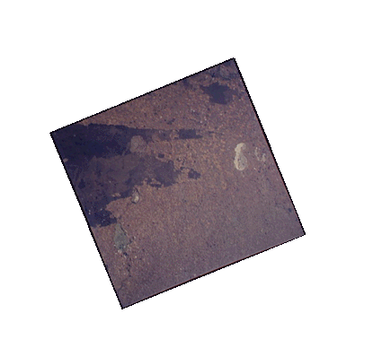
Cameras pointing directly downwards capture images that correspond closely to regular map projections. When Astronauts take photos with hand-held cameras, however, they are usually pointing fore or aft or off to a side. The resulting images appear distorted when compared with corresponding areas on maps. To relate photos to areas on maps, they must be stretched. Click on the links to see the photograph stretched to correspond to a map. Images from space frequently require transformation so that distances and areas can be measured and images from various sources can be compared. |
|
![[Image]](JavaScript:showImage('frame1.gif'))
![[Image over Map]](JavaScript:showImage('frame2.gif'))
![[Image stretched to fit]](JavaScript:showImage('frame3.gif'))
![[Area of image on Map]](JavaScript:showImage('frame4.gif'))